
 Search
Traveling Luck for Kobirāli Assam, India 
 Explore around
Kobirali?
Explore around
Kobirali? Wikipedia near Kobirali
 Where to stay near Kobirāli
The timezone in Kobirali is Asia/Calcutta
Morning Sunrise at 04:28 and Evening Sunset at 18:11. It's Dark
Rough GPS position Latitude. 26.6500°, Longitude. 92.0167°
Morning Sunrise at 04:28 and Evening Sunset at 18:11. It's Dark
Rough GPS position Latitude. 26.6500°, Longitude. 92.0167°
Weather near Kobirāli Last report from Gauhati, 101.9km away
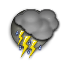 thunderstorm rain Temperature: 27°C / 81°F
Wind: 20.7km/h South/Southeast
Cloud: Few at 1000ft Scattered at 1800ft Few Cumulonimbus at 2500ft Solid Overcast at 8000ft
Satellite map of Kobirāli and it's surroudings...
Geographic features & Photographs around Kobirāli in Assam, India
populated place a city, town, village, or other agglomeration of buildings where people live and work.
- Kobirāli (0km)
- Kālāigaon (12.2km)
- Paneri (18.6km)
- Nalbāri (23.3km)
- Udalguri (23.8km)
- Khoirābāri (25.2km)
- Khārupatia (25.8km)
- Dimākuchi (28km)
- Dalgaon (28.1km)
- Rowta (30.5km)
- Puthimāri (30.5km)
- Orāngajuli (32.5km)
- Mangaldai (33km)
- Kaupāti (33.4km)
- Khoirābāri (34.1km)
- Pathārughāt (34.6km)
- Nāokāta (38.8km)
- Atharikhāt (39.4km)
- Daifam (39.6km)

- Batābāri (40.6km)
- Pithākhāitigaon (42.2km)
railroad station a facility comprising ticket office, platforms, etc. for loading and unloading train passengers and freight.
 Wikipedia entries close to Kobirāli
- Udalguri city o
- Kharupatia city o
- Rangia city o
- Dhekiajuli city o
- Darrang District adm2nd adm2nd
- Dhing city o
- Samdrup Jongkhar District adm1st adm1st
- Noonmati city o city
- Gauhati city b city
- Dispur city o city
- Rangapara city o
- Sualkuchi city o city
- Lokpriya Gopinath Bordoloi International Airport airport airport
- Bomdila city o
- Tezpur Airport airport airport
- Palasbari city o