
 Search
Traveling Luck for Aghitu Syunikʼ, Armenia 
Alternatively known as Aghudi, Agudi
 Explore around
Aghitu?
Explore around
Aghitu? Wikipedia near Aghitu
 Where to stay near Aghitu
The timezone in Aghitu is Asia/Yerevan
Morning Sunrise at 05:29 and Evening Sunset at 20:17. It's Dark
Rough GPS position Latitude. 39.5153°, Longitude. 46.0808°
Morning Sunrise at 05:29 and Evening Sunset at 20:17. It's Dark
Rough GPS position Latitude. 39.5153°, Longitude. 46.0808°
Weather near Aghitu Last report from Gyanca Airport, 75.4km away
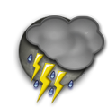 thunderstorm in vicinity Temperature: 23°C / 73°F
Wind: 20.7km/h West
Cloud: Scattered Cumulonimbus at 3000ft Broken at 10000ft
Satellite map of Aghitu and it's surroudings...
Geographic features & Photographs around Aghitu in Syunikʼ, Armenia
populated place a city, town, village, or other agglomeration of buildings where people live and work.
- Aghitu (0km)
- Noravan (2.1km)
- Uyts (3.2km)
- Vaghatin (4.1km)
- Sisian (5.1km)
- Ghzljugh (7.2km)
- Vorotan (7.3km)
- Yeremes (7.6km)
- Tolors (8.2km)
- Shamb (9.7km)
- Ashotavan (10.1km)
- Shak'i (10.9km)
- Akhlat'yan (10.9km)
- Darbas (11km)
- Brrnakot' (11.5km)
- Ltsen (12.1km)
- Bnunis (12.4km)
- Getat'agh (12.9km)
- Hats'avan (13.3km)
- Lor (14.7km)
- T'asik (14.8km)
- Balak' (15.2km)
- Torunik' (15.4km)
- Angeghakot' (16km)
- Salvard (17.8km)
- Muts'k' (18.3km)
- Hardzis (18.4km)
- Shaghat (18.7km)
- Shenat'agh (19km)
- Zovaber (19.4km)
- Dastakert (20.4km)
- T'anahat (20.7km)
- Soflu (20.9km)
mountain an elevation standing high above the surrounding area with small summit area, steep slopes and local relief of 300m or more.
- Gora Farmashtepe (10.5km)
- Gora Yantapa (10.9km)
- Gora Kyzyldzhuk (12km)
- Gora Shishtapa (13.2km)
- Böyük İsıqlı Dağı (13.7km)

- Aghja Lerrnagagat' (14.2km)
- Khdyr Dagh (16.7km)
- Mech'et'yu Lerr (18.2km)
- Gora Kechal-Dag (18.4km)
- Yerrablur Lerr (18.7km)
- K'arazhayrr Lerr (19km)
- Qızıltǝpǝ Dağı (20km)
- Kazuch'i Lerrnagagat' (21.3km)
- Gora Dzhangurtarani (21.5km)
stream a body of running water moving to a lower level in a channel on land.
reservoir(s) an artificial pond or lake.
- Tolorsi Jrambar (7.5km)
- Shambi Jrambar (9.9km)
- Angeghakot'i Jrambar (15.8km)
lake a large inland body of standing water.
- Qaragöl (19km)
- Jinli Lich (20.7km)
pass a break in a mountain range or other high obstruction, used for transportation from one side to the other [See also gap].
- Pereval Irimis (4.4km)
first-order administrative division a primary administrative division of a country, such as a state in the United States.
- (( Sisiani Shrjan )) (12.5km)
peak a pointed elevation atop a mountain, ridge, or other hypsographic feature.
- Gelija Lerrnagagat' (6.2km)
waterfall(s) a perpendicular or very steep descent of the water of a stream.
- Shakinskiy Vodopad (10.4km)
monastery a building and grounds where a community of monks lives in seclusion.
- T'anahati Vank' (20.5km)
 Wikipedia entries close to Aghitu
- Sisian city o
- Dastakert city o city
- Goris city o
- Каджаран city j city
- Lachin city o city
- Jermuk city o city
- Dar-Alages volcano mountain
- Nakhichevan adm1st adm1st
- Вайк city k city
- Porak volcano mountain
- Ghazanchetsots Cathedral church
- Şuşa city i city
- Stepanakert city g city
- Naxçıvan (Stadt) city g city
- Yeghegnadzor city o city
- Meghri city o city
Airports close to Aghitu
Tabriz international(TBZ), Tabriz, Iran (188.2km)Zvartnots(EVN), Yerevan, Russia (194.3km)