
- Asia
- Armenia
- Gegharkʼunikʼ
- Kyasaman
-
 Search
Traveling Luck for Kyasaman Gegharkʼunikʼ, Armenia 
 Explore around
Kyasaman?
Explore around
Kyasaman? Wikipedia near Kyasaman
 Where to stay near Kyasaman
The timezone in Kyasaman is Asia/Yerevan
Morning Sunrise at 05:28 and Evening Sunset at 20:21. It's Dark
Rough GPS position Latitude. 40.2831°, Longitude. 45.7322°
Morning Sunrise at 05:28 and Evening Sunset at 20:21. It's Dark
Rough GPS position Latitude. 40.2831°, Longitude. 45.7322°
Weather near Kyasaman Last report from Gyanca Airport, 42.3km away
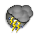 thunderstorm in vicinity Temperature: 22°C / 72°F
Wind: 23km/h West
Cloud: Scattered Cumulonimbus at 3000ft Broken at 10000ft
Satellite map of Kyasaman and it's surroudings...
Geographic features & Photographs around Kyasaman in Gegharkʼunikʼ, Armenia
populated place a city, town, village, or other agglomeration of buildings where people live and work.
- Kyasaman (0km)
- Arp'unk' (0.1km)
- P'ok'r Masrik (3.5km)
- Avazan (4km)
- Karaiman (5.2km)
- Kakhakn (5.2km)
- Norakert (5.5km)
- Geghamasar (6.6km)
- Mets Masrik (9.4km)
- Aghyokhush (10.2km)
- Kutakan (11.2km)
- Vanevan (12.2km)
- Agëkhush (12.9km)
- Kyarkibash (13.7km)
- Vardenis (13.7km)
- Tretuk' (13.8km)
- Inakdag (13.8km)
- Areguni (14.9km)
- Kamyshlu (15km)
- Khach'aghbyur (15.5km)
- Tuskyulu (16.4km)
- Shatvan (16.5km)
- Torfavan (16.8km)
- Tsovak (16.8km)
- Sot'k' (17.3km)
- Shatjrek (17.6km)
- Akunk' (17.6km)
- Geghamabak (18.4km)
- Kükürd (18.8km)

- Azat (19.2km)
- Gasan-Nana (19.8km)
- Jaghats'adzor (20.2km)
- Daranak (20.3km)
- Yariuzlu (21.3km)
- Ayrk' (21.9km)
- Kut' (22.2km)
- Norabak (22.6km)
- Almaly (22.8km)
- Geghak'ar (22.9km)
- Karchaghbyur (22.9km)
- Karakoyun (23.4km)
stream a body of running water moving to a lower level in a channel on land.
mountain an elevation standing high above the surrounding area with small summit area, steep slopes and local relief of 300m or more.
- Böyük Ağdaş Dağı (12.7km)
- Qocadağ (12.9km)
- Gora Airumcha (19.3km)
- Gora Gasan-Kala (21km)
- Qaraarxac Dağı (23.7km)
peak a pointed elevation atop a mountain, ridge, or other hypsographic feature.
- Vozunk' Lerrnagagat' (16km)
- Mets Gilant'agh Lerr (21.6km)
- Khat'abala Lerrnagagat' (22.5km)
- Ziaret T'ap'a Lerr (22.9km)
canal an artificial watercourse.
- Mazrinskiy Kanal (12.1km)
airfield a place on land where aircraft land and take off; no facilities provided for the commercial handling of passengers and cargo.
- Mets-Mazra (11.8km)
first-order administrative division a primary administrative division of a country, such as a state in the United States.
- (( Vardenisi Shrjan )) (15.7km)
mountains a mountain range or a group of mountains or high ridges.
- Sevani Lerrnashght'a (19.3km)
 Wikipedia entries close to Kyasaman
- Porak volcano mountain
- Sewansee lake waterbody
- Nerk'in Getashen city o city
- Artsvashen city o city
- Chambarak city o city
- Дадиванк landmark landmark
- Jermuk city o city
- Gavar city o city
- Xanlar city i city
- Dar-Alages volcano mountain
- Armenien country country
- Yeghegnadzor city o city
- Gäncä city d city
- Geography of Armenia country country
- Вайк city k city
- Berd
Airports close to Kyasaman
Zvartnots(EVN), Yerevan, Russia (138.5km)Lochini(TBS), Tbilisi, Georgia (200.7km)